We knocked out Tennessee on the list of riding in 50 states by riding a
short section of the Music City Bikeway (map here) in downtown Nashville.
I guess this "Music City Bikeway" is part of the "Cumberland River Greenway", as this sign was also along the route.Shrugs.I really don't know.
The section of trail that we rode is urban. And sketchy. In fact, I'm pretty sure those two terms are
interchangeable.But before you judge
too harshly, understand that the author of this post is a small town chick who
is not really comfortable with big city downtowns in general, especially when
on my bike. And most especially when the parking lot we had intended to park in
to access the trail is right across the street from the jail.Razor wire topped chainlink fence and
all.
And that was just the beginning of the sketchiness.
In the short 2.53 miles (and, yes, that's round trip)
that we rode this trail we rode past empty lots....
...... a creepy abandoned building missing a whole lot of glass....
..... and through the middle of a cement mixing plant.Alrighty then.
And by the time we reached this part of the trail...
...... we looked at each other and said "Far enough?"And we very quickly mutually agreed "far
enough" indeed.
It was at this spot we found one of the items we were looking for on our
bike scavenger hunt Facebook page that we play along with, the Bicycle Ride and Seek Challenge (see full post about that
here).The score:A boxcar with graffiti.
So, that mission being accomplished, we turned the bikes around and headed
back to our car.
We had this view of the downtown Nashville skyline with an impressive
thunderhead looming behind it.
And the AT&T building that I think looks like Batman. Anyone with me on
this?
Now, to be fair, here are some more positive impressions of the trail:
Green trees near where we ended up parking.
A barge on the Cumberland River.
A horse drawn carriage.
Some type of old industrial riverfront building that had been repurposed
into apartments.
An interesting fish sculpture.
A rusty railroad bridge with the lights of the Tennessee Titans stadium
visible behind it.
We knocked out Kentucky on the list of riding in 50 states by riding the
Paducah Greenway Trail en route to a family reunion in Florida.
We parked in the Paducah Expo Center parking lot and started the trail at
Campbell Street and rode to North 8th Street (US 45X) and back.
This section of the trail is built on the levee along the Ohio River.
There were a couple of scenic spots with nice benches and a pergola to sit
in shaded comfort and enjoy the view of the Ohio River....
... and an overlook of the bridge over the Ohio River connecting Paducah to Brookport,
Illinois.
Incidentally, it was a steel deck bridge that we had just driven over to get
to the trail, and it is not a bridge intended for the faint of heart.
Going down....... steeply!
While the view to the west from the trail was for the most part scenic, if
you turned your head to the east, the view was more, um........ industrial ... ... and aromatic.......
But it is a paved trail allowing cyclists a 3 mile round trip stretch of unimpeded
riding that only has to cross one street. A town with any greenway is better than no
greenway.
We were in Wichita this weekend to watch our daughter run in the state track meet at Cessna Stadium on the Wichita State University campus.We took our bikes with us and got two rides in during our 2-day stay.
On Friday night, after her 7:40 pm race, we found a neighborhood park that had a trail in the Park City suburb. No pix of this as it was getting dark. In fact, by the time we finished up at 9:15, it WAS dark and we were using our headlights and tailights. Very nice little park that even included a fishing pond. We saw a little family of ducks on the trail around the pond-- a mom and dad and 3 half grown babies. So sweet! It was a fun relaxing ride and we got 5 miles in.
On Saturday after her 1:40 race, we headed west to Goddard to ride the Prairie Sunset Trail. You can also click here for the website of the Prairie Travelers, the group that manages the trail.
The Prairie Sunset trail is a rail-trail that is 8 miles in length and connects the towns of Goddard on the east and Garden Plain on the west. The trail actually starts 2 miles east of Goddard, but we had been told there is no parking at the east end and that the trailhead in Goddard would be the best place to park. Our plan was to ride the 12 miles round trip from Goddard to Garden Plain and back, and when we returned back to our starting place would then decide if we felt up to the other 4 mile round trip to follow the trail east out of Goddard.
Here we are at the Goddard trailhead.
I need to give a shout-out to Randy of Randy and Nova's Bicycle Scrapbook for my awesome shirt that I am wearing. He is a fellow Kansas bike blogger from the Wichita area and a few months ago my husband won this shirt in a giveaway on their Facebook page. We thank you very much for your generosity.
So, we hit the trail and headed west out of Goddard. The in-town portion of the trail is paved. Once you get to this street and the local school district's bus storage facility, the trail turns into gravel.
(Side note: The Goddard school district has, what appears to me at least, to be an insane number of school buses. These are not even all of them.)
It was a beautiful 85 degree day with a breeze, but not a terrible wind that you had to battle. A lot of this trail is not shaded, but we never felt overheated in today's conditions.
There are enough intermittent shaded spots that we felt completely comfortable the entire ride.
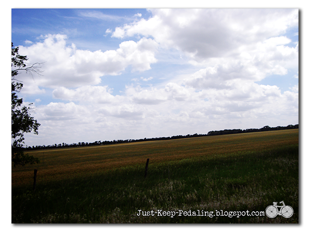
Beautiful Kansas vistas surround you for most of the trail.
The trail surface was in excellent condition. This was really the only spot that had weeds growing up in the middle. I'm really not a fan of trails with tall weeds growing in the middle that are constantly brushing against my legs as I ride, so the fact that this was the one and only spot like this on the entire 8 mile trail gets a two thumbs up from me!
This weed was happily existing alongside the trail, not in the middle of it, and I should know its name but I don't. I think it is pretty neat, though. It looks like a giant dandelion, with a head the size of a shower puff.
But enough about weeds, how do you like my hat? :) It's a RockiNoggins helmet cover. They are now available on Amazon -- sweet!!!
I have written a couple of other blog posts about them here and here.
Sadly, I was informed a few months back by a couple of girls that live in my house that "everybody makes fun of me with my helmet hats." I took that to mean one of two things, or probably both:
1) Everybody makes fun of me.
2) I am humiliating the teenage daughters. And I'm sad to say that that actually hurt my feelings. And then I came to this realization:
It's their problem. Not mine.
Riding my bike makes me happy. And wearing my (what I think are cute) helmet covers makes me happy, so why should I let what other people may think about me or my hats steal my joy?
So, here's another shot of cuteness, a view from above. Oh, and by the way, it is giraffe print, not cow. I made the flower accessory, too, with my own two little hands.
And now, enough about fashion and teenagers....... Back to the trail.
You have to cross several roads, some gravel country roads, some 55 mph highways, but the traffic was not heavy on any of them. Here's one of the highways. You can still see remnants of the rails from the railroad.
Drink break!
We rolled into the Garden Plain trailhead, greeted by this nice covered bridge. Nice touch, Garden Plain citizens. It's the support and volunteerism of the citizens of a town that determine the success of a trail.
A portion of the old tracks still exists at this trailhead.
We turned around and headed back to Goddard. After a few miles on the way back, we stopped at this bench for an off-the-bike rest time to get some blood flowing back into areas that had gone "seat numb."
Happened upon a surviving "whistle" sign that signaled to the train engineers when to blow the whistle for an upcoming road crossing.........
And a bike.......
....... chained to a tree ...
..... that, judging from the rust on the chain, had apparently been there for quite some time.
Not really a Geocouch find, and we couldn't really get on it to take a proper picture, but this is the best we could do. LOL. This one's for you, Randy, though I'm sure you are well aware of this bike's existence anyway. :) What a Dork in that picture.. did it break your camera!?! S~~
And then my sweet husband said, "I planted these flowers just for you." I love that guy. Love you Too! S~~
The Goddard skyline welcomed us back.
We decided to continue east out of Goddard for the remaining 2 miles of the trail. The first mile was a bit of a struggle from the combination of some thick gravel, an long upward grade and riding into the wind in a very open and unsheltered section. The second and last mile was the least maintained of all the trail with still a lot of large ballast rocks that required either engaging in an obstacle course or enduring having your teeth rattled. It unfortunately resembled the state of the rail-trail that exists on on the outskirts of our town.
Here is a picture of what the undeveloped portion looks like beyond the easternmost point of the trail.
Overall, we had a very pleasant 16 mile ride on a extremely well maintained trail, encountering 3 other people utilizing the trail during the time that we rode: Two separate walkers and another cyclist.
Great day, great trail!
~~H
Yeah! What she said! :) Really surprised the only reptile we saw was a turtle! S~~
Been super busy between work and trying to get my Mustang ready for a trip to a car show in June that I have not gotten much bike riding done this spring. So my Sweetie and I made a deal that at least one day this weekend we would go for a bike ride. So on Sunday since we were halfway to Council Grove doing one of our odd jobs, we decided to go on to CG and eat lunch and then head out on the trail and see how far we could get before I pooped out!
Here is a little peek at my 1985 Mustang project before we get started. Completely replacing 28 year old suspension parts.
Enough about cars! This is a blog about bicycling which currently is a better mode of transportation than above car! :)
It rained off and on Saturday so the trail was a bit soft in places but quickly dried. So we had to dodge muddy spots as we rode along. The surface as you ride out from Council Grove is smooth but has a tendency to get muddy in places because it appears to be clay based.
Council Grove Trailhead off Dunlap Road
Not far out from Council Grove we spotted our first animal of the ride, I spotted a turkey running down the trail away from us. Not long after that she exclaimed what's that standing along the edge of the trail. Visions of the World's Largest Prairie Dog in Oakley, Ks danced in my head as I told her that's what it was, our talking startled it into scampering off into the grass. The song I'm Alright by Kenny Loggins always makes an appearance in my rapid channel shifting brain whenever I see a Prairie Dog. thanks to Caddyshack! I know gophers and prairie dogs are not the same animal. They both dig holes in the ground! The association in my brain doesn't care! :)
Now back to our ride!
Along the trail, I believe by S 525th Rd there is an old stone school house or church that they are working on repairing. We stopped and took some pictures on our way back by.
<3 Photobombed by a Bunny!
We rode on out to S 400 Rd which was roughly 5 miles out. We stopped to take some pictures because the view was quite breathtaking. Not sure pictures do it justice.
Camera is facing South-Southwest
About midway through our ride the trail surface changed to a little heavier gravel surface which I much prefer. Its easier to ride on especially if the surface is a little wet. Us bigger folks don't sink in so much! :) Plus it seems to hold up better with less maintenance. All in all it was an enjoyable ride that ended up being a little over 10 miles by the time we got back. We did see one small snake and another turkey. That was all for animal sightings outside of your normal birds, rabbits, and squirrels. I am outta here, So Long and thanks for all the Fish! oops I mean Just Keep Pedaling!
S~~
We also encountered six other cyclists on our ride.... three separate groups of two. Good to see it being utilized. ~~ H