Showing posts with label video. Show all posts

Tuesday, February 28, 2023

Mississippi River Basin Model -- Clinton/Jackson, Mississippi (no biking)

Let's just start off with what needs to be said:  This thing needs to be a part of the National Park Service.  Now. Full stop. 
 
What was initially just a random Fotospot find (“Hey it’s right off the interstate, and we’re not on a terribly tight schedule today, so we might as well go get it for the 15-point Fotospot check-in”), turned into what we both agree was a golden hidden treasure find. We had no idea this existed. None.  
 
After seeing this in person, we both agree on this:  How this project is sitting abandoned and vandalized instead of under the auspices of the National Park Service is something neither of us can understand. We are encouraged to see that though it was abandoned decades ago by the Corps of Engineers as a working project, the site is not completely neglected. It has an active organization, the nonprofit Friends of the Mississippi River Basin, doing monthly clean up activities at the site according to their active Facebook page.

The scientific and historical relevance of this project is an integral part of mid-20th century America. This article explains what a flood-control engineering and lifesaving marvel this truly was, in the era predating computer modeling.
 
This article from the April 1948 issue of Popular Science gives an account from that era of the project, including photos of what it looked like when it was in operation.
 
It appears there are hopes to develop this site. Check out this awesome master plan map on the Friends of the Mississippi River Basin Model website and the proposed project on the architect's website here.   As with everything, it likely comes down to money.
 
What will it take to get this into the National Park Service?  According to the criteria on this PDF:

"A proposed unit will be considered nationally significant if it meets all four of the following standards:
 
• it is an outstanding example of a particular type of resource.

• it possesses exceptional value or quality in illustrating or interpreting
the natural or cultural themes of our Nation’s heritage.

• it offers superlative opportunities for recreation for public use and enjoyment, or for scientific study.

• it retains a high degree of integrity as a true, accurate, and relatively unspoiled example of the resource."
 
My opinion of why each of the 4 criteria are met are below (for all that's worth):
1.  Likely the BEST (and by far the largest) example of its particular type. -- Check.

2. Its scientific value in modeling, forecasting and preventing flooding of the Mississippi River in the era predating computer modeling was proven to prevent flooding in Omaha which prevented an estimated $65 million in damages in that instance alone, and undoubtedly saved lives, according to the excellent scholarly article, "The Scale of Nature: Modeling the Mississippi." --  Check.

3.
Superlative opportunities for recreation, public use and enjoyment: You get to walk around and pretend you're a giant in a Lilliputian sized world.  That's pretty damn recreational. And cool.   -- Check.
Superlative opportunities for scientific study:  Science saves lives. This is a scale-model STEM project, one that school children and adults alike should experience.  -- Check.
 
4. It retains a high degree of integrity as a true, accurate, and relatively unspoiled example of a resource due to the diligent and neverending work of the volunteer nonprofit organization.  Having it under the maintenance of the National Park Service would ensure it retains its integrity for future generations. It is a very important but absolutely unknown national  treasure. -- Check
 
Let's get this done. It deserves to be a National Park.

The Mississippi River Basin model is in Buddy Butts Park and is open to the public. To get to the model, take the Springridge Road exit on Interstate 20, turn left at McRaven Road and go to where the road T's (you'll see the rusty water tower and this kiosk.)


You won't see the model from the kiosk. Don't be intimidated by the shoulder-high weeds.  There are paths mowed through them to walk back to the model
This building was the shop. Per the Friends of the Mississippi River Basin Model website "This is where the tools for upkeep on the model and the 4-wheeled 'mules' that were used for hauling things around were stored. There was also an office that had the various parts and equipment for repairing the instruments when they broke."
There are no designations naming where you are standing on the model, just some cryptic codes such as this.  Wish I knew what they mean.  Mile 420? 
If I read the map correctly on the Friends of the Mississippi River Basin Model website, this part of the model is the Mississippi River around Vicksburg/Baton Rouge.
See what looks like two miniature football goalposts in the center left edge of this picture? 
Based on pictures from when the model was in operation on my links provided above,
I believe those had signs on them designating town names.
One of the pipes that would have been used to supply water to the working hydraulic model.
Sure wish we knew where we were walking. That would ratchet up the cool factor even more.
Did the curb like things going through the word "pedaling" in this picture represent existing levees?
Not sure what topography this is supposed to represent.
Again, is this representing levees along a river?
There are mountains of this accordian'ed wire mesh lying about in many places.
It apparently had been used on the model to simulate trees so the effects of foliage on the water flow could be accurately represented.
Assume this is one of the pumps?
More mesh.
Wasn't kidding when I said there were mountains and mountains of mesh.
The heavily vandalized Baton Rouge Control House.
Per the Friends of the Mississippi River Basin Model website: "The control houses were located along the major streams and housed the flow programmers, stage recorders and automatic calendars to provide control centers for operating the automatic instrumentation (MBM Report 1-6, August 1971). The Baton Rouge House was also used for offices. This was where work was done on reports and the records kept."
Looking down to the Baton Rouge Control House from the observation deck.
Video will be added when I have time to get it edited and put together.

Sunday, July 24, 2022

The Most Toxic City in America -- Picher, OK: A Modern Ghost Town

On a trip to Arkansas, rolling south along Hwy 69, we happened upon the (recently) abandoned -- in the last dozen years -- lead-poisoned town of Picher, Oklahoma.  With both of us being unaware of the existence of this place just beyond our state's border, it was quite shocking to drive into a town with a new-looking freshly-painted water tower proclaiming "Picher, Home of the Gorillas since 1918" ---  but there was no town, there were no houses, other than a cluster of brick duplexes near the water town, with a decidedly apocalyptic vibe. There was no window or door glass in any of them and the weeds were asserting dominance. 


Across the street from the water tower was what appeared to be a small memorial plaza. 


And a gorilla statue 


proudly noting a football state championship in 1984.


It's a "blink-and-you'll-miss-it" kind of town and we were through it before either of us could really register what we had just witnessed.  Steve did mention "holy crap, this looks like a Superfund town."  I'm 53 years old and I don't really know what "superfund" means, although I recall hearing the term when I was a kid back in the early 80s. We did not stop on our first trip through. I'll admit it gave me a creepy, disturbing vibe .... but I was also intrigued. I spent that evening once we arrived at our destination Googling "Picher, Oklahoma" and diving deep down the rabbit hole.  That sealed the deal.  Although we had intended to take a different route home, I convinced the husband to drive out of the way on the return trip so we could come back and explore Picher.

A brief history of Picher's rise and fall is provided on the placards that are placed at the memorial plaza with the gorilla statue. 


Picher was settled as a zinc/lead mining town in the 1920s and the mines were in operation until the 1970s. Lead from the mines was used to provide a large number of bullets in both World Wars. 
 
A remnant of the mining era.

As a residual of that mining activity, the town is surrounded by chat piles hundreds of feet high, very visible on Google satellite view. Mountains of carcinogenic and neurologic toxicity.
 
Google Maps satellite view demonstrating the dozens of chat piles surrounding Picher, Oklahoma.
For decades, kids played on these piles and families picnicked on them. Townspeople mixed the chat with cement to pour their driveways. They used the chat as filler in their kids' sandboxes. They even swam in the tailing ponds. 
 
The citizens undertook all these activities unaware of the extreme toxic danger this posed. The slag piles are composed of lead dust that poisoned the air they breathed and the water they drank, swam, and bathed in. 
One of the dozens of toxic lead piles that surrounds the town.

 
After swimming in the tailing ponds, they assumed they just had a sunburn, when in actuality their reddened skin was the result of chemical burns. 
 
It wasn't until the mid 1990s that awareness began to dawn. A school counselor and/or the Bureau of Indian Health (I've found both referenced) noted there were a large number of kids in the school district exhibiting learning difficulties. Eventually all the students were tested for lead and an overwhelming percentage tested positive for toxic lead levels. 
 
The school complex is fenced off with "No Trepassing - U.S. Govt" signs

The football field and track.

Assuming this is the gym.


The school building was built in 1987, but the extensive undermining throughout the town has made all structures susceptible to being swallowed by sinkholes.

 
The EPA designated the area the "Tar Creek Superfund" in 1983 and deemed the area uninhabitable. The federal government ordered the entire town to permanently evacuate and provided the citizens with federal funds for relocation. 
 
An EF4 tornado in 2008 accelerated that process, destroying 168 buildings in town and killing 6 people. That was the final nail in the coffin for the town.
 
Alta Street, which saw a direct hit from the tornado. Houses at one time lined this street.

In
Google Maps screenshot of Alta St, March 2008 (two months before the F4 tornado on 5/10/2008)

In May 2009, the school graduated its last class of 11 students and the school voted to disband the district.
On September 1, 2009, the state of Oklahoma officially disincorporated the city of Picher, which ceased official operations on that day. The population plummeted from 1,640 at the 2000 census to 20 at the 2010 census. (Source: Wikipedia)
 
A decade later, during our visit on a Sunday afternoon in July 2022, the place is devoid of human presence, other than vehicles blowing through at 65 mph on Highway 69.  Save for the bombed-out-looking brick duplexes, there is not a house left in a town that at the turn of this century was a community of 1600 people, where families once came home every night after a long day at work, ate meals, celebrated holidays and birthdays, did homework and went to bed, in preparation for doing it all again tomorrow.  
 
The Picher of 2022 is a surreal landscape of grids of asphalt streets (still in good condition) bisecting empty lots that have been reclaimed by nature. 
 
If a picture paints a thousand words, this one demonstrates the tragedy that is Picher. The infrastructure of modern civilization (the paved streets, the utilities, the public fire protection), now abandoned, while in the background looms a mountain of lead dust that brought illness and death to its citizens and the town itself. 

Picher is an environmental catastrophe that may never be completely mitigated. 


Video of our drive through Picher:

Saturday, July 3, 2021

Oak Leaf Trail & Lakeshore State Park -- Milwaukee, Wisconsin

For 4th of July weekend 2021, we took a roadtrip to Wisconsin to ride the Oak Leaf Trail along the lakefront. 

Milwaukee by Bike tour -- July 2, 2021
14-mile ride

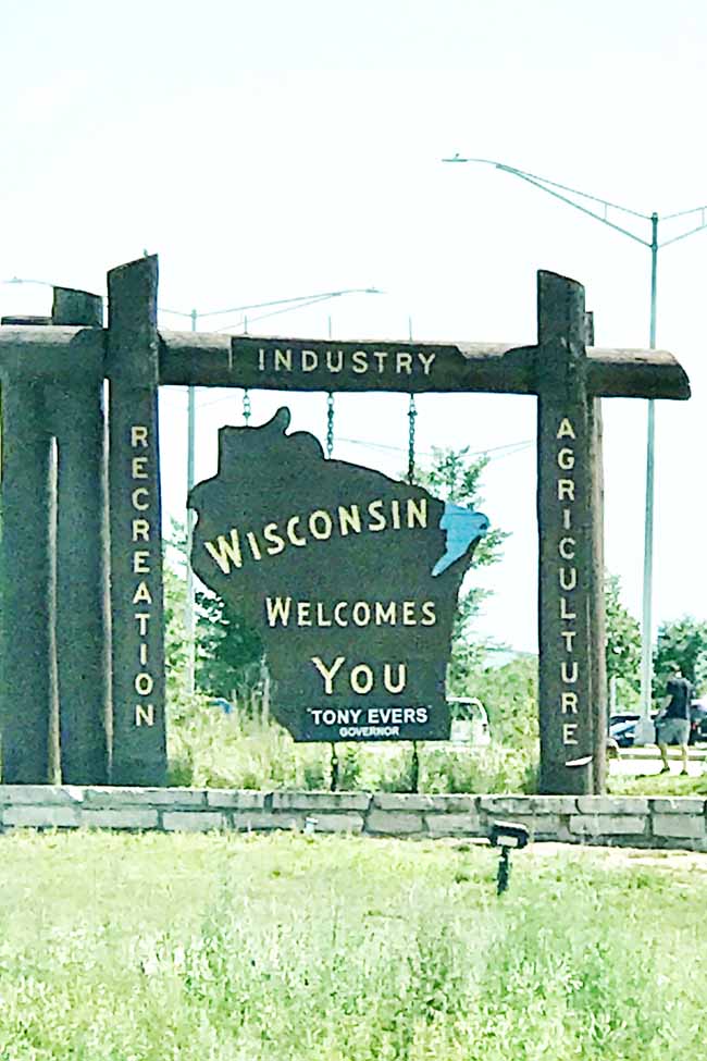
Welcome to Wisconsin!


We arrived midday on Friday.  Our plan was to do a bike tour that afternoon so we found a food truck in the parking lot where our tour was going to start.
She had the Dr Pepper braised pork shoulder taco with jalapenos and I had the grilled chicken thigh taco. The chips and salsa were excellente!
Behind the sign is where the shipping container of rental bikes was located. https://milwaukeebybike.com/
Unique art showing the wildlife of the area all in one mural
Milwaukee Pierhead Lighthouse
The Milwaukee skyline from the bay
Three hour tours....
Beach on Lake Michigan 

North Point Water Tower https://city.milwaukee.gov/water/about/North-Point-Tower


Cool octopus mural
"Heineken!? F😇k that sh😇t! Pabst Blue Ribbon!"   
Steamboat Captain and Beer Baron Frederick Pabst  (the statue, that is......  The pensive guy is Steve.)
Root Beer drinking Hot Momma!
Patron Saint and King of Beer & Brewing, King Gambrinus.

Gandhi
Aaaaayyyyyy!  We touched the jacket and lived!
Milwaukee Riverwalk

Originally the Milwaukee Electric Railway and Light Co, now the Milwaukee Rep theater
Dinner at Kopp's Frozen Custard, recommended to us as a Milwaukee-must-visit.
Building looks like an old Bank  https://www.kopps.com/
The apparently famous "line of cows" in the back parking lot
Steve had a Bacon Cheeseburger with grilled onions
Hand for reference.  Hamburgers were huge!
We shared onion rings
She had the July sundae of the month -- Smores.  Yum!!!!


Oak Leaf Trail and Lakeshore State Park-- July 3, 2021
32.5 mile ride

Saturday we got up and got on the Oak Leaf trail right from our hotel parking lot
Only took about 5 miles to get back to the waterfront
Getting her seagull fix!!!! 
Yes that is Lake Michigan outside those breakers
Looking south towards the city skyline
The two tallest buildings in town  -- US Bank and Northwestern Mutual duking it out!
Perspective
Somebody drew a fun face on this pylon!
Milwaukee Art Museum. Very unique building. The wings on the top can raise and lower.
Interesting shimmery art installations. I don't know the story behind them. But they are cool.
Schooner built in 2005 (I think) by the Milwaukee Discovery Center science museum
Bird sculptures are titled ReBirth.
https://urbanmilwaukee.com/2021/06/11/visual-art-five-foot-tall-birds-coming-to-lakeshore-state-park/

Beaver Alert! We actually spotted this beaver sunning himself on the rocks as we rode by.
That black dot in the water is the above beaver later taking a swim.
Rocking the Beaver Shots!       (OMG, stop! -- the wife)
Snack time!  Enjoying a Repleo Bar! https://www.repleo-nutrition.com
Southshore Beach
https://county.milwaukee.gov/files/county/parks-department/Park-Maps/southshore.pdf

Contemplation.. Do I touch it? :D
Oooh! That's cold!
Lakeshore State Park
Tallest 4-sided non-chiming clock in the world!
Stopped at Riverfront Pizzeria for lunch and some cold beverages! She had root beer on tap and I had Summer Shandy.  
https://mkeriverfront.com/

Sat out on the patio along the Milwaukee River
We shared a yummy Thai Chicken Pizza
The birds have taken over!
Nap time.  So cute!!!!
Bradford Beach was packed this 4th of July weekend.  Covid is still a thing.
Northpoint Lighthouse.  You can't even see this lighthouse from the shore now, but it used to be cliffside.
One of the 8 lions of "8 Lions Bridge" keeping watch over the lighthouse.
I absolutely adore cats. Even majestic stone ones. 


OK, so check this out. In 2014, a semi truck, whose driver was apparently following what the GPS was telling him/her/they to do, drove down this bike path in the middle of this park (literally the middle of this park -- I invite you to Google Map Northpoint Lighthouse and look at how deeply into the park on this bike path s/he/they actually drove -- it's mind blowing).

Source: www.WISN.com
Neat Urban Ecology center along the trail
Waiting while I take pictures of the mural!
Community garden
Dinner on the rooftop at Good City Brewing  https://www.goodcitybrewing.com/
Relaxing on the rooftop after our 32+ mile bike ride!
Got to have the cheese curds when you are in Wisconsin!

For him: Mac & Cheese w/Grilled Chicken
For her: Nicoise salad: Green beans, potatoes, olives, tomatoes and blackened tuna
Hit the DQ on the way home for some ice cream!


High Trestle Trail, Madrid, Iowa -- July 4, 2021
12-mile ride

 
To break up our 9-hour drive home, we stopped and did a 12-mile ride along the High Trestle Trail from Madrid to Woodward. We have ridden this before more than once. Here is our blog post of one of rides in 2014: http://just-keep-pedaling.blogspot.com/2014/08/high-trestle-trail-slater-to-oasis-and.html