
Documenting our cycling shenanigans!
Wednesday, July 31, 2013
Sunday, July 28, 2013
Katy Trail - Boonville, MO Trailhead to the bridge over I-70
On our way home from St Louis today we decided to break up the drive by riding a portion of the Katy Rail to Trail that traverses the state of Missouri. Over the past several years we had noticed that the trail passed over I-70 near Boonville. So we decided that we would like to ride to that Bridge. We drove along I-70 coming from the east and not once saw a sign for the Katy trailhead exit for Boonville. There are 3 exits of I-70 so we stabbed a guess that the one for Historic Downtown Boonville would likely get us there. Once we were down the hill (Note this.. :) ) into Downtown, and still no signs indicating the Katy trailhead, we followed signs leading us to the Town Visitor Center. Well all be if there was not an MKT Caboose sitting outside the Visitor Center and just to the south of it lie the Katy trailhead. So we unpacked our little Fit, much to surprise of the locals who were amazed to see two bikes appear out of thin air! We then embarked on our mission to reach the bridge over I-70. We quickly learned that Boonville is at the rivers edge and I-70 is on top of the hills outside of town about 4 miles. So most of our trek to this bridge was going to be UPHILL! We passed several folks along the way out enjoying the beautiful weather. One unfortunately had run into a bit of trouble with his tire, so he was stopped repairing it. We wished him better luck for the rest of his day! We passed through a tunnel under an unknown road. That was about the highest point on the whole ride. From there we had a brief down hill run and then quickly back up hill to the Bridge. For the next 30 years as we drive under that bridge on our trips east we will look at each other and say... Remember that day we rode over that bridge.. and you couldn't get your @$!@! camera to turn on?? Lol Oh the wonderful memories we shall share! The rest of the trip was all down hill.... literally.. :) We coasted back to the Boonville. Took some cool photographs of us at the station and by the Caboose.. packed the bikes back up and headed West once again!
S~~


S~~
 |
| Getting ready to ride the KATY trail from the Boonville Trailhead |
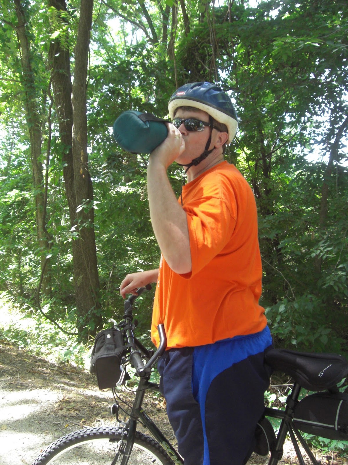 |
| It was quite muggy so I needed a drink rather quickly! |

 |
| Taking a rest on the nice bench! |
 |
| We call this synchronized sitting. |
 |
| That Caution sign should say Caution: Giant Hole!! |
 |
| Tunnel under the road. |
 |
| K I S S I N G! Celebrating making it to the Bridge over I-70! |
 |
| View from South side of the Bridge |
 |
| View looking East from the bridge |
 |
| Back on the North side of the Bridge |
 |
| K I S S I N G! Celebrating making it back to Boonville! |
 |
| Boonville Station |
 |
| K I S S I N G! Celebrating our big Caboose! |

 |
| Air Station provided at the Boonville Train Station Visitors Center |

 |
| Old Railroad Bridge we rode across as we were leaving Boonville! |
McKinley Bridge - Venice, IL over Mississippi River and back; Confluence Trail along the levee
S~~
When researching options for riding over the Mississippi River from St. Louis to Illinois, the first hit we came upon was the Chain of Rocks Bridge, a rather uniquely shaped historic bridge on the old Route 66 that today is solely a pedestrian and bike bridge. Cool, right? Well, that was my first thought. However, after more reading, we discovered that the safety of the parking options, even on the Illinois side, is iffy at best. But the thing that absolutely made the hair stand up on the back of my neck was learning of the horrifying and heinous crime that was committed there in 1991, at a time when the bridge was abandoned. The victims were two sisters, one who would have been my age. After discovering that, there was no way I could go be all touristy and take pictures at a place where something like that had happened. I just couldn't. No.
So, I was very relieved to find the McKinley Bridge over the Mississippi River with its protected bike lane and what appeared to be perfectly safe little parking area in Venice, Illinois, at least at 9:30 on a Sunday morning.
~~H
 |
| Getting ready to ride the McKinley Bridge! |

 |
| The apparently perfectly safe little parking area in Venice, Illinois |
 |
| Bet none of these guys actually built the bridge! |


 |
| One foot in Missouri and One in Illinois! |
 |
| Mississippi River and Downtown St Louis viewed from the middle of the McKinley Bridge |

 |
| My Sweetie! |
 |
| Ground must be berry interesting! |

 |
| Yes I am still a teenager at Heart! Had to spit down the drain hole! :) |
 |
| View of the McKinley bridge from the Trail |
 |
| Rut Roh! Trail Closed! Made our ride rather short! |
 |
| When did we travel to Italy! Lol And time travel? :) |
Saturday, July 27, 2013
Lower Meramac Park Greenway -- St. Louis, MO
For our second ride today, we checked out Lower Meramac Park Greenway that follows along the Meramac River. We parked at the I-55 trailedhead which was not well marked (read -- not marked at all, at least where you could see it from the road), but we found it. Again, a very nice wooded paved path that follows along the Meramac River (wish we had things like this where we live.......) with lots of fun curves and slight hills that gives variety and keeps the ride interesting. This was also a trail that was being heavily utilized on a mid-70 degree late July Saturday at 5:00 in the afternoon: Walkers, joggers, people with dogs and strollers and kids on bikes with training wheels, and other cyclists. Which is awesome. That means it is being used. Which is the whole point of trails like this -- and also how they get paved. Again, I reiterate, I wish we had something like this where I live. Well, we almost did, but then it all got thrown away, but that's the topic of another blog post that I might delve into at another time..... As far as the Lower Meramac path in St. Louie, one of the websites we read before our ride stated that it will flood during times of high water, and evidence of that was quite obvious at several points on the trail. Large portions of it had obviously been underwater this spring.
~~H
Can you believe this weather! Mid 70's on the 27th of July! Unbelievable! Made for a very nice second ride of the day! We chose an easy paved trail through the woods along the Meramac River. There were several spots where if you made a miscalculation in your speed and steering that you could have ended up wet! As my Sweetie mentioned there were several parts of the trail that recently had to have the mud scrapped off after having been a submarine trail instead of a bike trail. I would ride this one again!
S~~
 |
| Description of the Meramec River Greenway |


 |
| This Dork keeps following me! |
 |
| Nice view of the Meramec River from the trail |
 |
| My Sweetie with her Montague X-50 |
 |
| K I S S I N G ! |
Mississippi River Greenway -- St. Louis, MO
This morning we toured the Missouri Civil War Museum, an apparently relatively new museum on the grounds of Historic Jefferson Barracks. Our plan had been to then ride the trails on the Jefferson Barracks grounds. However, upon pulling into the parking lot of the trailhead and seeing the high number of users utilizing the, what appeared to be somewhat narrow, paved trail as walkers, a large percentage of them being 70 and older, but no bicyclists in evidence anywhere, we said "Nope, we don't want to be the cause of a broken hip from a possible pedestrian/bike mishap", so we nixed that trail. We drove around the park a little bit more, attempting to find a memorial he wanted to look at and while doing so, happened upon a trail still within the Jefferson Barracks grounds named the Mississippi River Greenway. As we saw a couple cyclists utilizing this trail, we decided to ride this instead. It was a short 2 mile ride following along the Mississippi River, a very nice trail, with some fancy bridges and traveling past a casino, before it abruptly ended--rather without warning--at the bottom of a hill just as you came around a curve. Perhaps a sign at the top of the hill and the start of that curve might have been an apopros addition to warn cyclists that a dead-end trail and 3 boulders awaited them around the bend with gravity in force. Quite a few users, cyclists, walkers, and joggers were encountered on this 11:00 am Saturday morning ride.
~~H
Thankful to be here still to post on our blog after having a scare this morning. Was cycling on the Mississippi River Greenway... a nice little trail. Minding my own business... Going down a steep grade as part of a blind curve. Suddenly there was a cement pilon across the trail signaling its end. If it weren't for my trusty brakes I would now be a human pancake. A sign of warning that there was a pancake maker ahead might be an upgrade for that portion of the trail. That aside, we did visit a wonderful recently opened Missouri Civil War Museum at Historic Jefferson Barracks. I am fascinated with the Civil War so very much enjoyed seeing Missouri's telling of their side of the war. Will look forward to returning for a visit in a few years when they have increased their collection of memorabilia.
S~~
 |
| Missouri Civil War Museum at Jefferson Barracks Matching shirts -- the pinnacle of dorkdom! ~~H |
 |
| Missouri Civil War Museum Building |
 |
| More neat old buildings at Jefferson Barracks. Actually still being used by Missouri National Guard |
 |
| My Sweetie Horsing Around! |
 |
| Who's that Dork? |
 |
| Entrance to the Greenway |
 |
| Notice the Casino off to the right |

 |
| Only had this on Video.. Abrupt end to the Trail! (I chose not to take a picture of this because, honestly, I think our videoing was enough to freak out that jogger who was perched on it having her mid-run break!) ~~H |
 |
| Not sure what this contraption was |
 |
| Ooooh! She's giving me Cooties! |
 |
| Long uphill Bridge to get back to the car! |
Subscribe to:
Posts (Atom)